
Kodagu District
Kodagu District |
About: |
|
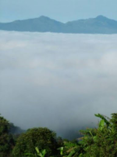
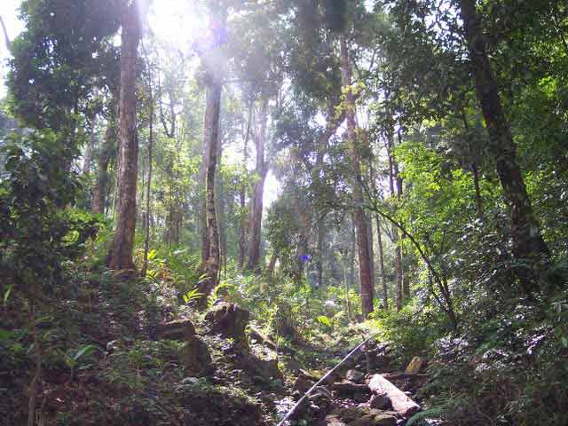
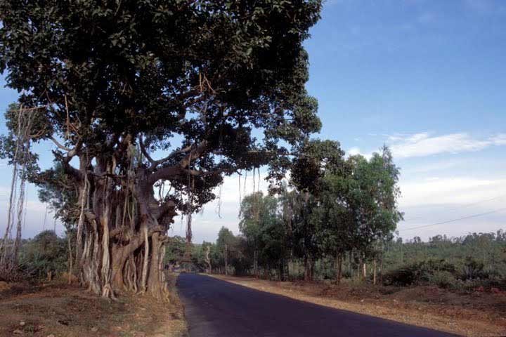
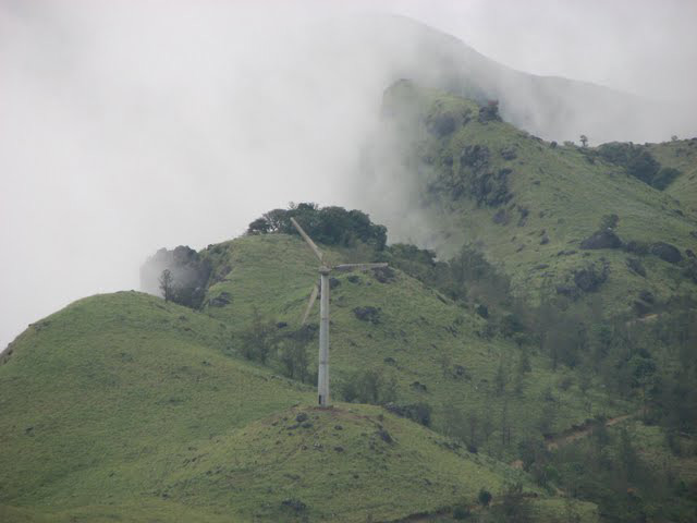
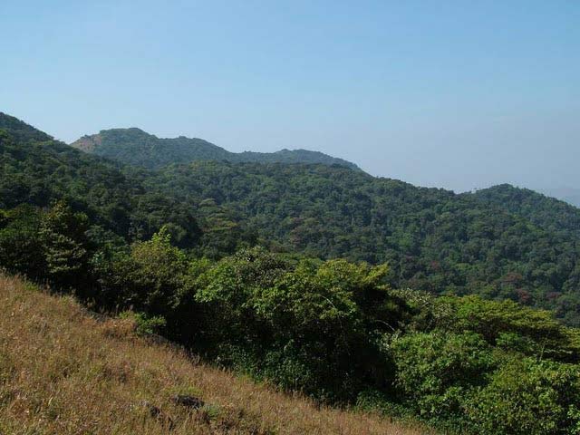
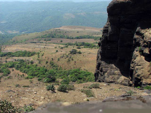
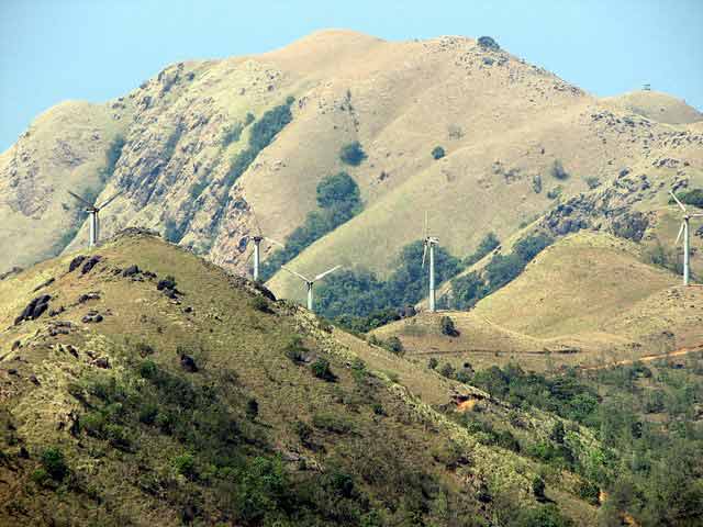
Kodagu (Coorg) District, the erstwhile kingdom of the Hoysalas and Vijayanagar is a picture perfect hill station in Karnataka that houses a treasure trove of diverse culture. Covering an expanse of 4102 sq. km, Kodagu (4000 m elevation) is encircled by Dakshina Kannada, Hassan, Mysore and Kannur District of Kerala state and Wayanad district of Kerala.It is also known by its anglicised name of Coorg. It occupies about 4,100 square kilometers (1,580 mi2) of land in the Western Ghats of southwestern Karnataka. As of 2001, the population was 5,48,561, with some 13.74% of the population residing in the district's urban centers. Kodagu's capital is Madikeri. The district is bordered by Dakshina Kannada District to the northwest, Hassan District to the north, Mysore District to the east, the Kannur District of Kerala to the southwest, and the Wayanad District of Kerala to the south. The 2001 Census quotes Kodagu's population indices at 5,48,561. This rural district's economy depends primarily upon agriculture, plantation and forestry. The coffee plantations and orange groves of Coorg are renown all over the world.Kodagu is one of the smallest districts in Karnataka comprising of 3 taluks Madikeri, Somwarpet and Virajpet. Kodagu District's pristine verdant forests and sun kissed terrains specked by snow white coffee blossoms captivate tourists. Bestowed with a resplendent history and traditional legacy, Coorg attracts tourists by the droves. The district has a mountainous configuration which presents a grand panorama of verdant valleys, ravines, fast flowing streams, lofty peaks and awe inspiring spurs. The major peaks are Tadiandamol, Brahmagiri and Pushpagiri Hills.The largest river in Kodagu district is the Cauvery with its principal tributaries Hemavathi, Lakshmanathirtha, Kakkabbe and Harangi or Survanavati, flows in an easterly direction and river Barapole flows towards west.Kodagu is a veritable botanists' paradise with more than 1,300 species. |
Location info: |
| Kodagu (Coorg),is bordered by Dakshina Kannada to the northwest, Hassan District to the north, Mysore District to the east, Kannur District of Kerala state to the southwest and Wayanad district of Kerala to the south. |
Climate/Weather: |
|
The climate of Kodagu is cool, equable and pleasant. The district has very moist rainy monsoon climate.
|
History: |
|
Kodagu was a kingdom rulled by the Hoysalas from the 11th to the 14th century A.D. and thereafter by the Vijayanagar kings and the Chengalvas. The Wodeyars of Kodagu ruled from the 17th to the 19th century. The British annexed Kodagu in 1834 after dethroning Chikkaveerarajendra Wodeyar. It was administered by Chief Commissioners till Independence and then in 1952, as a category 'C' state, had a representative in the Rajya Sabha. Upon the reorganisation of states in 1956, Kodagu became a district of Karnataka State. The Kodavas were the earliest agriculturists in Kodagu, living in that place for centuries. Nayakas and Palegaras like Chengalvas and Kongalvas ruled over them. Over centuries several South Indian dynasties, like the Kadambas, the Gangas, the Cholas, the Chalukyas, the Rastrakutas, the Hoysalas,and the Vijaynagar Rayas, ruled over Kodagu. Kodagu was a kingdom ruled by the Hoysalas from the 11th to the 14th century CE, and thereafter by the Vijayanagar and the Chengalvas. The Haleri Rajas of Kodagu ruled from the 17th to the 19th century. In between the Mysore Sultans invaded and ruled Kodagu for a couple of decades in the eighteenth century. The British annexed Kodagu in 1834, after dethroning Chikkavirarajendra the last Haleri Raja. The province was administered by Chief Commissioners until Indian Independence in 1948. The last Chief Commissioner of Coorg was Ketolira Changappa.[3] Kodagu was granted a representative in the Rajya Sabha as a category 'C' State in 1952. In the re-organisation of States which took place in 1956, Kodagu became a district of Karnataka State. |
Educational Institutions: |
|
Institutions
|
Langauge |
| Kodavas are the main ethnic group. Gowdas, Brahmins, Christians and Jains are other communities who live in Kodagu. The local language, Kodava, has influences of Kannada, Malayalam and Tamil. |
Culture: |
|
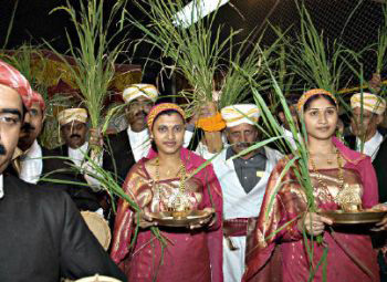
There are three main festivals: the Festival of Arms or Kailpodhu, Kaveri Shankaramana and the harvest thanksgiving at Puttari (puthari). These three festivals occur between September and December. Kailpodhu Kaveri Sankramana Puttari On the day of Puttari, the whole family assembles in their ain mane (the common family house), which is decorated with flowers and green mango and banana leaves. Specific foods are prepared: thambuttu, puttari, kari and poli poli. Then the eldest member of the family hands a sickle to the head of the family and one of the women leads a procession to the paddy fields with a lit lamp in her hands. The path leading to the field is decorated. |
How to reach? |
| Nearest Railway Station:Mysore, Hassan, Mangalore & Tellicheri. |
| Nearest Airport:Mangalore Airport and Bangalore Interntional Airport. |
|
Road Transport: Kodagu is well connected with all season motorable roads. It is well connected by K.S.R.T.C buses from all over Karnataka, particularly from Bangalore, Mysore, Mangalore & Hassan. Distance
Bus Stations
|
Tourist Attraction |
|
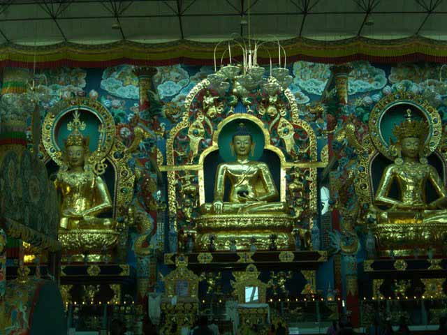
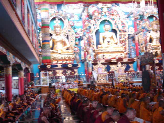
Fort and the Palace:The fort stands on an elevated ground and is visible from any part of the town. The original mud fortress was rebuilt in stone by Tipu Sultan The ground plan of the palace is an irregular hexagon with circular bastions at six angles. The palace situated inside the fort was rebuilt by Lingarajendra II in brick and mortar between 1812 and 1814. Raja's Seat:This is a small square mantapa in brick and mortar of four pillars bridged by arches, enhanced by beautiful surroundings. This lovely spot was a favourite place of recreation for the Rajas and hence was permanently associated with them. It is built on a high level ground with a commanding view of the cliffs and valleys to the west. Triveni Sangam: A sacred site for the Hindus, Bhagamandala is on the banks of the confluence of three rivers, Cauvery, Kannika and a mythical river Sujyothi, to form the 'Triveni Sangam'. Tadiandamol (5,724 ft) is the highest peak of the district and is situated near Nalknad Palace which is 40 kms from Madikeri. Beelur Golf Club: HARANGI:A reservoir with picturesque spot is one of the main attractive tourist centre at a distance of 9 kms from Kushalnagar. Best season to visit is between August and December. Malemalleshwara Betta: Coorg: Situated on the Western Ghats of Karnataka, Coorg is a hill station in Kodagu District boosting an exotic natural environment. Coorg is commonly known as the 'Scotland of India' as well as 'Kashmir of the South'. This beautiful hill lies between 3000 and 4000 ft above sea level Abbey Falls: Pushpagiri or Subramanya hill, the celebrated mountain is in the north-west of Kodagu, about 36 kms from Somwarpet and 1.5 km from Kumaralli, which is amidst jungle.Starting from Bhagati, at the base of Pushpagiri, it is about 10 kms walking, the ascent taking a good walker about three hours. The summit commands an extensive view of Kodagu, Dakshina Kannada, Hassan and Mysore. Brahmagiri Hill :Particularly the young and the able bodied, climb up about 300 feet to the summit of the Brahmagiri peak where, it is said, the seven great sages meditated. Dubare: Omkareswara Temple Kushalnagar is just 32 Kms from Madikeri, and 87 Kms from Mysore.From here, by hiring a taxi, you can cover Cauvery Nisargadhama, Harangi and Dubare in one trip. CAUVERY NISARGADHAMA:Forest department is maintaining this wonderful picnic spot, on the banks of river Cauvery, near Kushalnagar. The hanging bridge, pedal boat center, tree top shelters, elephant safari, deer park are the main attractions of Cauvery Nisargadhama. Nagarahole: Bhagamandala: Bylakuppe Tibetan Settlement Gandhi Mantapa:To the left on the way to Raja's seat a mantapa is built on the sacred mortal remains of Mahatma Gandhi in 1956. There are two royal tombs at Madikeri. Veerarajendra began the construction of the royal tomb on a hill commanding a view from all directions to the north of Mahadevpet. Igguthappadevara betta, in the proximity of the Aiyengeri forest near Kakkabbe , is a lofty peak and is a pilgrim centre for the Coorgs in particular and other Hindus in general. Worshippers from all over the district congregate at the shrine and offer poojas and sometimes "Tulabhara", weighing oneself with rice or coconuts and offering the same to the deity along with some money. Honnamana Kere: Mallalli Falls: Pushpagiri Wildlife Sanctuary Talakaveri: Nagarahole game sanctuary was constituted in 1955, and extends over 111 sq. miles of reserved forests in the eastern region of the district. The game sanctuary comprises three forest ranges namely, Nagarahole, Kallahalla & Thitimathi. The sanctuary is situated at the distance of 105 kms from Madikeri. Nisargadhama: Iruppu Falls: |
Hotels/Lodge/Accommodation: |
|
Madikeri (STD: 08272)
Virajpet (STD: 08274)
Somwarpet (STD: 08276)
|
Kodagu District Major Attraction |
| Cauvery Nisargadama |
| This place is located in the Kodagu (Coorg) district of Karnataka very close to Kushal Nagar. Nisargadhama is around 120 kms from Mysore and around 260 kms from Bangalore. Located 4 kms before Kushal Nagar (when driving from Mysore), it is a small and circular island formed by the branching of river Cauvery....more |
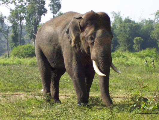
| Kabini WildLIfe Sanctuary |
| Kabini is one of the most popular wildlife destinations of Karnataka, probably because of its easy accessibility, lush green landscape surrounding a large picturesque lake, and fantastic sightings of large herds of elephants. It is 80 km away from Mysore and 205 km from Bangalore, and comprises the south-eastern part of Nagarole National Park....more |
| Brahmagiri Wildlife Sanctuary |
| Brahmagiri Wildlife Sanctuary, located in Kodagu District covers an area of about 181 sq km. It is surrounded by evergreen and semi-green forests as well as shola grasslands....more |
| Pushpagiri Wildlife Sanctuary |
| Pushpagiri Wildlife Sanctuary is one of 21 Wildlife Sanctuaries of India's Karnataka state. This sanctuary is located near Mandalpatty in Somwarpet taluk of Kodagu district and has some attractive scenery. Spread over 102 sq km, the sanctuary is situated in the Western Ghats and has thick evergreen and semi-evergreen forests....more |
| Talakaveri Wildlife Sanctuary |
| Talakaveri Wildlife Sanctuary is a wildlife sanctuary in Southern Karnataka state of South India. It is located in Kodagu district and is spread over 105 km2 and lies in the Western Ghats. This sanctuary is named after Talakaveri, the origin of the Cauvery River which lies on the eastern edge of the sanctuary....more |
| Rajiv Gandhi National Park |
| Nagarhole National Park, also known as 'Rajiv Gandhi National Park,' is located 94 km from Mysore in Karnataka in Southern India. It is spread between Kodagu and Mysore districts. Located to the northwest of Bandipur National Park, Kabini reservoir separates the two....more |
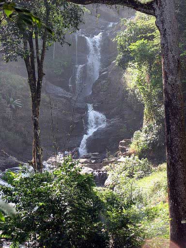
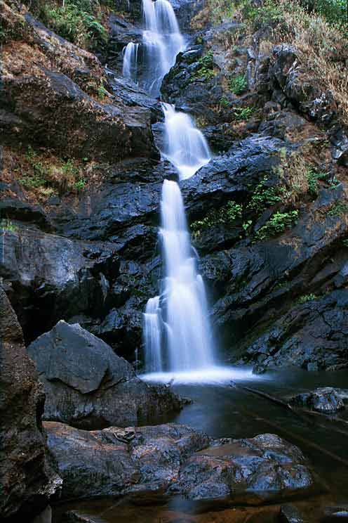
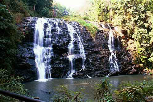
| Abbey Waterfall |
| Karnataka boasts of some scenic and exotic hill stations that are frequented by those seeking the green and serene. Among them one such location would be the Abbey falls. This waterfalls also known as the Abbi falls....more |
| Irpu / Iruppu Waterfall |
| Irpu falls (or Iruppu falls) is situated at outskirts of Brahmagiri mountain range of Kodagu district. The falls is formed by Lakshmana theertha river when it jumps down in two tiers from a height of 52 mtrs (approximately 170 ft). The Irpu Falls, also known as the Lakshmana Tirtha Falls....more |
| Mallalli Waterfall |
| Mallalli falls is situated in the foots of pushpagiri hills. It in about 18 kms from somwarpet, the falls is 2 kms inside the main road. Mallalli Falls is situated in Coorg and is around 25 kms from Somwarpet and 260 kms from Bangalore....more |
| Nisargadhama Falls |
| Nisargadhama Falls in Karnataka is about 25km on the way to Madikeri from Bangalore. 2 kilometers from Kushalnagar, Nisargadhama is a beautiful island carved by the Cauvery. Karnataka's geographical topography is dominated by the Western Ghats that is the source of many rivers flowing though out the land....more |
| Lakshmana Tirtha River |
| The Lakshmana Tirtha is a river of India that has its origin in Kodagu district and flows eastward. It joins the Kaveri River in the Krishna Raja Sagara lake. Kodagu is a district of Karnataka State in Southern India. It is also known by its anglicised name of Coorg. It occupies about 4,100 square kilometers (1,580 mi2) of land in the Western Ghats of Southwestern Karnataka....more |
| Kaveri River |
| ....more |
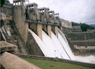
| Harangi Dam |
SELECT YOUR HOLIDAY DESTINATION
-
Aero Sports in Karnataka
-
Archaeology in Karnataka
-
Beaches in Karnataka
-
Bird Sanctuaries in Karnataka
-
Bouldering Spot in Karnataka
-
Camping in Karnataka
-
Cave Explorations in Karnataka
-
Culturals Place in Karnataka
-
Dams in Karnataka
-
Districts Of Karnataka
-
Fairs in Karnataka
-
Festivals in Karnataka
-
Go Karting in Karnataka
-
Hill Stations in Karnataka
-
Historical Places in Karnataka
-
Holiday Resorts in Karnataka
-
Islands in Karnataka
-
Landscape in Karnataka
-
Mountain Biking in Karnataka
-
National Parks in Karnataka
-
Orbit Network
-
Para Sailing in Karnataka
-
Pilgrims Destinations In Karnataka
-
River rafting in Karnataka
-
Rivers in Karnataka
-
Rock Climbing in Karnataka
-
Safari in Karnataka
-
Temples in Karnataka
-
Trekking in Karnataka
-
Water Sports in Karnataka
-
Waterfalls in Karnataka
-
Wildlife Sanctuaries in Karnataka


