
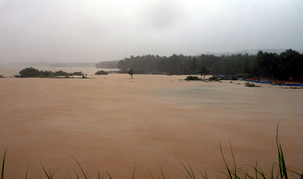
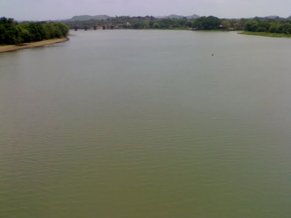
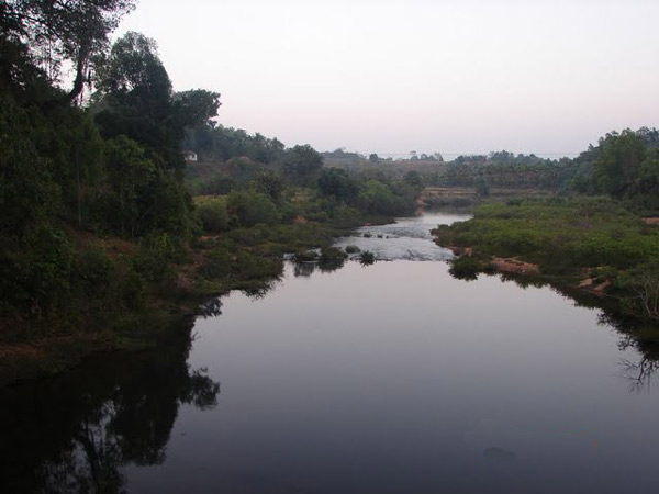
Pangala river
Pangala River |
About: |
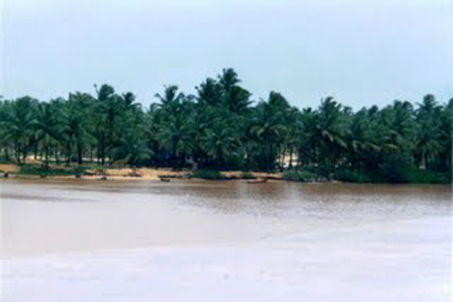
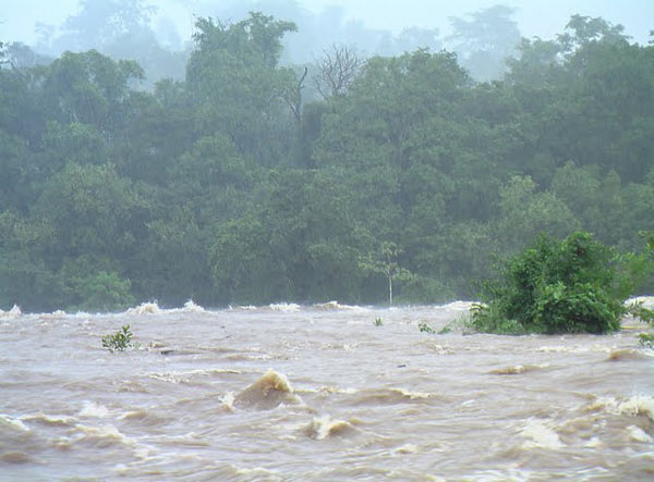
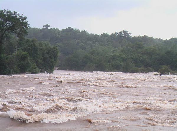
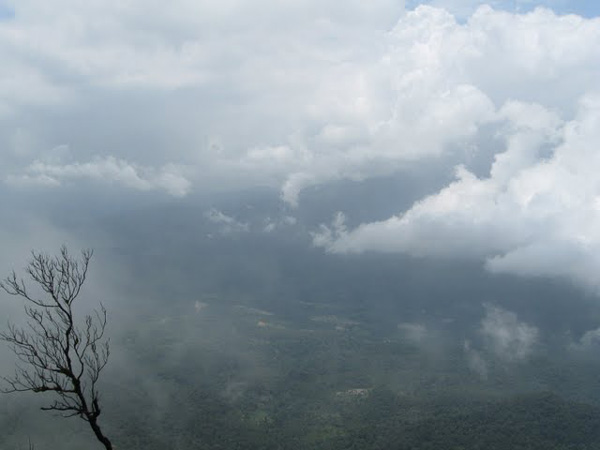
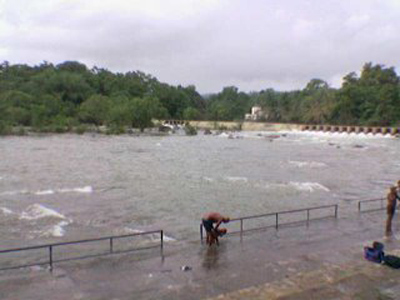
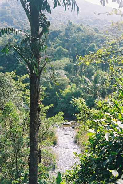
| Pangala is a village situated in Udupi taluk of Udupi district, Karnataka. India's National Highway number 17 (NH-17) road connecting Mangalore (Kudla or Mangaluru) to Mumbai (Bombay) passes through this village.The village is on the north banks of Pangala river. The Pangala river joins Arabian sea near Matti (village) .The Shankarapura village which is famous for its jasmine flowers is near by. The Janardhan temple of pangala village is being renovated.
Udupi is a city and the headquarters of the Udupi District in the Indian state of Karnataka. Udupi is famous for the Krishna temple located here. It also lends its name to the Udupi cuisine which is famous across the world. It is widely believed that the name of Udupi was derived from its Tulu name Odipu. The Tulu name in turn is associated with a temple at Malpe, devoted to Vadabhandeshwara. Another story is that the name Udupi came from the combination of the Sanskrit words Udu and Pa, which mean "stars" and "lord." According to legend, the moon's light was once reduced due to a curse by King Daksha, whose 27 daughters (the 27 stars, according to Hindu astrology) were married to the moon. The moon prayed to Lord Shiva to get back its original shine. Lord Shiva was pleased with the moon's prayer and restored its shine. Legend says that the moon and his wives made their prayer at the Chandramouleeshwara temple at Udupi, creating a linga that can be seen even today. According to this story, therefore, Udupi means the land of the "lord of the stars," the moon. |
Location info: |
| Address:Pangala is a village situated in Udupi taluk of Udupi district, Karnataka. |
| District:Udupi district |
| Nearest City:Udupi Taluk |
| Best time to visit: in winters (from December to February) |
Climate/Weather: |
| The climate in Udupi is hot in summers and pretty good in winter. During summers(from March to May) the temperature reaches up to 40°C and in winters (from December to February) it is usually between 32°C and 20°C. The Monsoon period is from June to September with average rainfall and heavy winds. |
History: |
Interesting things to do: |
| Bhuta Kola, Aati kalenja, Karangolu, and Nagaradhane are some of the cultural traditions of Udupi. The residents celebrate festivals such as Diwali, Dusshera and Christmas. Folk arts like Yakshagana are also popular.
Rathabeedhi Geleyaru, a local non-profit organisation, was founded to encourage creative pursuits, especially those that keep alive the traditions of the region. Its primary focus has been drama. |
Interesting things to Visit: |
| The daily sevas (offerings to god) and administration of the Krishna Mutt are managed by the Ashta Mathas (eight temples). Each of the Ashta Mathas performs temple management activities for two years in a cyclical order. They are collectively known as the Krishna Matha. The Krishna Matha is known throughout the world for its religious customs, traditions, and learning in Dvaita or Tatvavaada philosophy. It is also the centre of Daasa Sahitya, a form of literature that originated in Udupi. These eight Mathas are Pejavara, Puttige, Palimaru, Adamaru, Sodhe, Kaniyooru, Shirur and Krishnapura |
Mobile range info: |
How to reach? |
| Nearest Railway Station:Udupi has a railway station on the Konkan Railway. |
| Nearest Airport:The nearest airport to Udupi is Mangalore (Bajpe) Airport, which is 50 km away. |
| Road Transport:National Highway 17 passes through Udupi. Other significant roads include the State Highways to Karkala and Dharmastala and to Shimoga and Sringeri. The NH 17 provides a link to Mangalore and Karwar. Private as well as government buses connect Udupi to various parts of Karnataka. City and suburban transport is available for travel within Udupi and suburbs. The buses originate from the suburban bus stand (City Bus Stand). There are different route numbers. The nearest harbour/port to Udupi is Malpe, which is 5 km away. New Mangalore Port/Harbour is 50 km away from Udupi. |
Nearest Visiting places: |
Nearest Petrol Pump: |
| Udupi |
Hotels/Lodge/Accommodation: |
Things to carry: |
Tips & Suggestions: |
| Udupi is getting modernized day by day retaining its image as a pilgrimage centre. Lot of developments are taking place in the city and many projects are in pipeline. |
Help Line/Phone Number: |
| Police Station:Udupi |
| Nearest Hospital:Udupi |
| Society/Community Phone Number |

Pangala River Nearest Attraction |
| St. Mary's Island |
| Located 58 km north of Mangalore, the St. Mary's Island beach is special for the unique formation of basalt rocks which have crystallized into columns and split into vertical hexagonal blocks. This group of islands is accessible by ferry from Malpe which is a major fishing harbor.....more |
| Kollur Temples |
| Kollur Mookambika Temple, an important seat of Shakti worship is located in very picturesque surroundings at the foot of the Western Ghats in Kundapur taluk of Udupi district. This sacred place is situated on the banks of river sauparnika and surrounded by thickly wooded hills and has a natural formation resembling the Sri Chakra. Kollur is one of the seven mukti places which were created by Parashurama.....more |
| Udupi Temples |
| Udupi, the Kokani city is the headquarters of the Udupi District, Karnataka State, India. When one hears the name "Udupi" either "Udupi Krishna" or "Udupi Masala Dosa" comes to the mind. Of course the famous, Krishna temple is located in this city. The temple is famous for a unique statue of Lord Krishna.....more |
| Kollur Forest |
| Kollur is a tiny hamlet situated 40km Kundapur Town, about 140 km away from Mangalore City in Karnataka state in Southern part of India. This village lies at the foot of the Western Ghats, and is famous for the Mookambika temple, a Hindu pilgrim center.....more |
| Mookambika Wildlife Sanctuary |
| Located in Udupi District, Karnataka, Mookambika Wildlife Sanctuary spans over 247 sq km and is thick with evergreen, semi-evergreen and moist deciduous forests of the Western Ghats, and small patches of teak plantations. It is contiguous with the Sharavathi Valley Wildlife Sanctuary.....more |
| Someshwara Wildlife Sanctuary |
| Located in the Western Ghats, Someshwara Wildlife Sanctuary in Udupi District of Karnataka. This 88 sq km sanctuary is consists of semi-evergreen and evergreen forests. Wildlife species include tiger, leopard, wild dog, jackal, gaur, wild pig, sambar deer, spotted deer, barking deer, lion tailed macaque, bonnet macaque and common langur.....more |
| Karkala |
| Karkala is a town and also the headquarters of Karkala Taluk in Udupi district of Karnataka, India, and is located about 300 km from Bangalore. It lies near the Western Ghats. The first name of this town was Pandya Nagari during the Jain regime but afterwards it was changed to Karikallu because of black stones.....more |
| Koosalli Falls |
| The fabulous picnic spot, Koosalli waterfalls is located near Koosalli village in Kundapura. A series of six falls, one above the other, in splendid surroundings makes it one of the best waterfalls in the state. The combined height of all six falls is about 380 ft....more |
| Gurupura or Phalguni River |
| Gurupura river flows through Gurupura, Mangalore, Tannirubhavi. It joins the Arabian sea near Tannir bhavi. is the chief port city of the Indian state of Karnataka. Bounded by the Arabian Sea and the Western Ghat mountain ranges, Mangalore is the administrative headquarters of the Dakshina Kannada (formerly South Canara) district in southwestern Karnataka.....more |
| Kedaka River |
| The Kedaka River is a river flowing through Kundapur and Gungulli in western India. It joins with the Souparnika River, Varahi River, Chakra River, and Kubja River and merges into the Arabian Sea.....more |
| Souparnika River |
| Souparnika River is a river flowing through Kundapur and Gangolli in western India. It joins with the Varahi River, Kedaka River, Chakra River, and Kubja River and merges into the Arabian Sea.Sauparnika is a sacred river which emerges from a verdant mountain near Maravanthe in Udupi District of Karnataka.....more |
| Udyavara River |
| Udyavara is a village on the outskirts of the town of Udupi, Karnataka, India. It is located to south of Udupi, and to the north of the Udyavara river. Udyavara was formerly called Udayapura. It was the capital of the Alupas.....more |
| Kaup Beach |
| Kaup Beach is located 12 km south of Udupi. It is situated on the coastal belt. The Kaup beach is one of the most beautiful beaches. Its placement is perfect. The beach with the 100 ft high lighthouse on the rocks is a photographer's paradise.....more |
| Malpe Beach |
| About 6 kms from Udupi, in South Canara is Malpe, an ideal picnic spot with its virgin beach. The endless stretch of golden sand, graciously swaying palm trees, the clear blue sky and the gurgle of the sea all set a perfect mood for an unforgettable holiday here....more |
| Trasi Beach |
|
Trasi is a beautiful place on the west coast of India, 100 km from Mangalore, 900 km from Mumbai and 12 km north from Kundapur.Here you can see a unique scene where a National highway separates the Arabian sea from the Sauparnika river.....more |
| Panna Island |
| ....more |
| Kudumari Falls |
| ....more |
| Seeta/ Seetha falls / Koodlu Theertha falls / Sita falls |
| ....more |
SELECT YOUR HOLIDAY DESTINATION
-
Aero Sports in Karnataka
-
Archaeology in Karnataka
-
Beaches in Karnataka
-
Bird Sanctuaries in Karnataka
-
Bouldering Spot in Karnataka
-
Camping in Karnataka
-
Cave Explorations in Karnataka
-
Culturals Place in Karnataka
-
Dams in Karnataka
-
Districts Of Karnataka
-
Fairs in Karnataka
-
Festivals in Karnataka
-
Go Karting in Karnataka
-
Hill Stations in Karnataka
-
Historical Places in Karnataka
-
Holiday Resorts in Karnataka
-
Islands in Karnataka
-
Landscape in Karnataka
-
Mountain Biking in Karnataka
-
National Parks in Karnataka
-
Orbit Network
-
Para Sailing in Karnataka
-
Pilgrims Destinations In Karnataka
-
River rafting in Karnataka
-
Rivers in Karnataka
-
Rock Climbing in Karnataka
-
Safari in Karnataka
-
Temples in Karnataka
-
Trekking in Karnataka
-
Water Sports in Karnataka
-
Waterfalls in Karnataka
-
Wildlife Sanctuaries in Karnataka


