
Pushpagiri
Pushpagiri |
Nearest Towns: |
| Somwarpet |
Location info:India->Karnataka->Bengaluru->Somwarpet |
| Distances:From Bangalore 300+ kms,12 km to top and 15 km to the Subramanya |
| Camping Sites: Forest check post, Bhattara Mane, Mantapa,The summit (Pushpagiri) |
| Trek Length: 12 Km to 15Km. |
Route Info: |
|
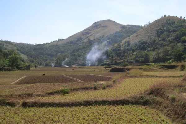
Kukke Subramanya is 22 km from Gundia, which lies on the Bangalore - Mangalore National Highway. Somvarpete can be approached from Madikeri (30 km) or from Mysore via K.R.Nagar and Ramanathpur. Bengaluru->Mysuru (Mysore)->Hunsur->Kushal Nagar->Somwarpet. Trekking ahead brings you to Mallahali Falls; you can take bath in clear waters here. Thereafter the major target to reach, crossing the Shola Forest, is Lingadahole-a perennial stream and beginning of the dense forest. Just after crossing the jungle there is a huge relief with the sight of shelter at Kudre doddi. Take a turn to Giri Gadde and Pushpagiri. Trekking for 4-5 hrs more will take you to Pushpagiri Hills. There are two approaches to Pushpagiri and Kumaraparvat peaks. While the eastern entrance is from, the western one is from. The access from Beedehalli- a small hamlet at the north-eastern entrance of Pushpagiri Wildlife Sanctuary is supposed to be less tough. |
Best Time To Visit: |
| October to early February; April to late May. |
Worst Time To Visit: |
| The forests are closed for public during summer to prevent forest fires. Pouring rains make the trek hazardous during monsoons.Jun to Sep |
Difficulty Level: |
| Moderate To Difficult |
Summary: |
|
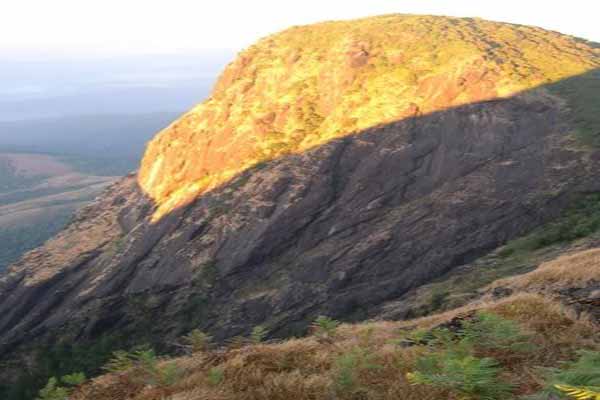
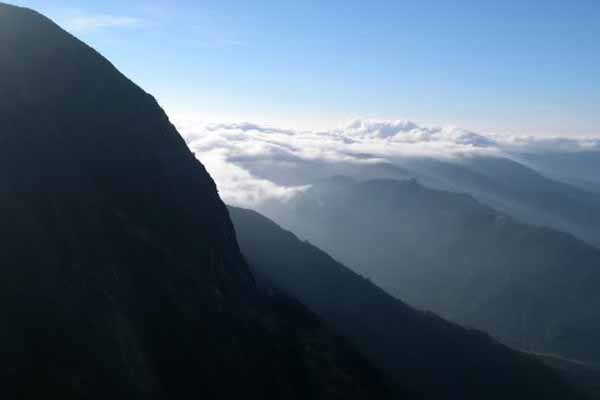
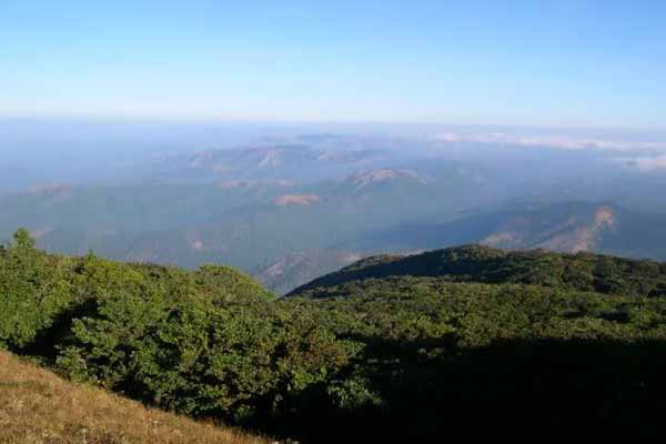
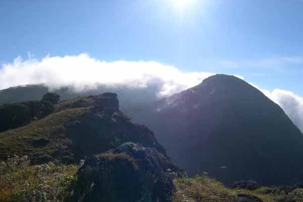
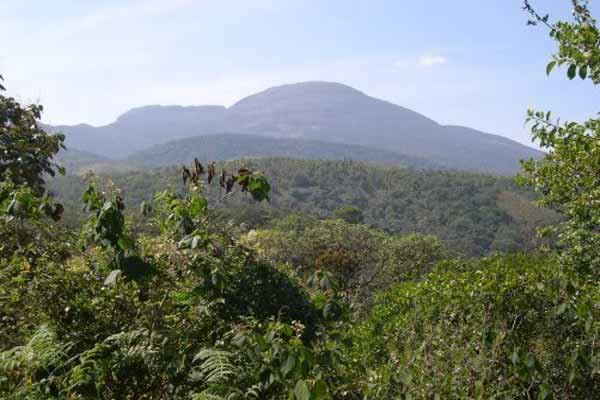
With over 35 % of its total geographical area under evergreen forest cover, Kodagu or Coorg is counted among the greenest districts in India. Much of these rainforest-clothed ghats, sprinkled with an array of waterfalls, are still pristine eternally inviting nature lovers and trekkers to get mesmerised by them. Among the many challenging forest peaks to scale here are Pushpagiri and Kumaraparvat, at the district's northern edge near its tri-junction with Hassan and Dakshina Kannada districts. Pushpagiri is the second highest mountain (5626 ft above the sea level) in Kodagu. Trekkers can cross to Subramanya, in Dakshina kannada district from Pushpagiri Range. Since, this mountain comes under the jurisdiction of Pushpagiri Wildlife Sanctuary prior permission from the Department of Forest is necessary for trekking. Trekking Distance is 12 Km to the top and 15 kms towards Subramanya. There is a well laid out road (tarred) from Kundahalli right upto the Heggademane and uptil the temple (earlier only a kaccha road existed).There is a Forest check post after a 15min walk from the temple and they charge Rs.115/- per head for the hike.After this check post once you start trekking you will pass two streams within a gap of 40 to 60mins. During summer these streams can go dry. After about 1hour you will reach a camping area with circular built walls (broken down) built of bricks. After 2 hours of walk you will reach a rock face where you can sight the Puspagiri peak (North face). After a 30mins walk from this point you will reach a rock face followed by even a bigger one where you will have to do a bit of rock climbing.Three hours will be a comfortable walk to reach the top from the Forest check post. |
Things To Look for: |
|
Things To Be Aware Of: |
|
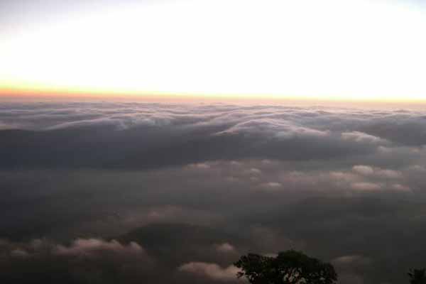
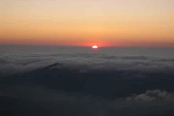
Streams and water sources dry up around November-end. The last usable water source is in the wooded area near Mantapa. You might find some water a little before the peak though, but it becomes stagnant after November, so dont use it for drinking. You get food at Bhattare Mane only at 1 PM, so, however early you reach, you should be prepared to wait until 1 PM and resume the trek at 3 pm or later. If you want a break and a good rest before you start in the afternoon, it is best to reach Bhattare Mane by 12 noon after taking a leisurely trek up and resume trek by 4 PM or so, after the sun has gone down a bit. It is extremely windy and cold at the peak. If you are camping at the peak in the open, be sure that your tents can withstand the strong winds.Carry sleeping bags to beat the cold at the peak. |
References |
| http://bharata.sulekha.com/blog/post/2006/12/western-ghats-trek-pushpagiri-and-kumaraparvata.htm |
Important Phone Numbers : |
| 944 864 7947 (Bhatru mane) |
Permission: |
| This trek route traverses through three different forest ranges all falling in different administrative circles with their offices far away from each other. Hence it is strictly advised to get written permission from the concerned officers before commencing the trek.To trek in Pushpagiri Wildlife Sanctuary:Chief Wildlife Warden Aranya Bhavan, Malleswaram 18th Cross, Bangalore 560003.Need to pay Rs 115 towards forest entry fee to the forest guards |
SELECT YOUR HOLIDAY DESTINATION
-
Aero Sports in Karnataka
-
Archaeology in Karnataka
-
Beaches in Karnataka
-
Bird Sanctuaries in Karnataka
-
Bouldering Spot in Karnataka
-
Camping in Karnataka
-
Cave Explorations in Karnataka
-
Culturals Place in Karnataka
-
Dams in Karnataka
-
Districts Of Karnataka
-
Fairs in Karnataka
-
Festivals in Karnataka
-
Go Karting in Karnataka
-
Hill Stations in Karnataka
-
Historical Places in Karnataka
-
Holiday Resorts in Karnataka
-
Islands in Karnataka
-
Landscape in Karnataka
-
Mountain Biking in Karnataka
-
National Parks in Karnataka
-
Orbit Network
-
Para Sailing in Karnataka
-
Pilgrims Destinations In Karnataka
-
River rafting in Karnataka
-
Rivers in Karnataka
-
Rock Climbing in Karnataka
-
Safari in Karnataka
-
Temples in Karnataka
-
Trekking in Karnataka
-
Water Sports in Karnataka
-
Waterfalls in Karnataka
-
Wildlife Sanctuaries in Karnataka


