
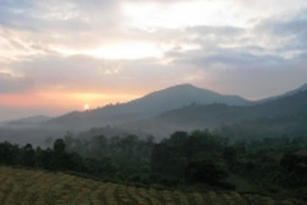
Tadiyandamol Peak
Tadiyandamol Peak |
|
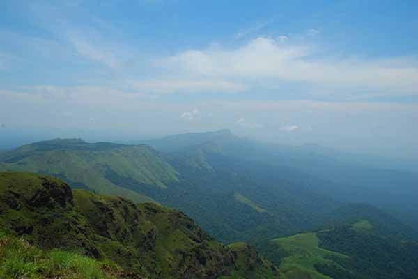
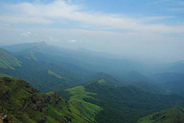
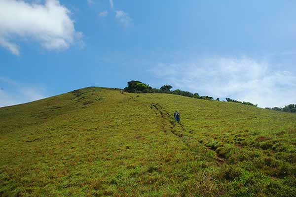
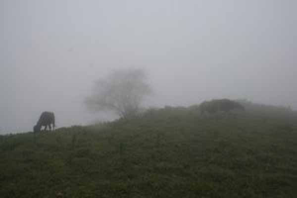
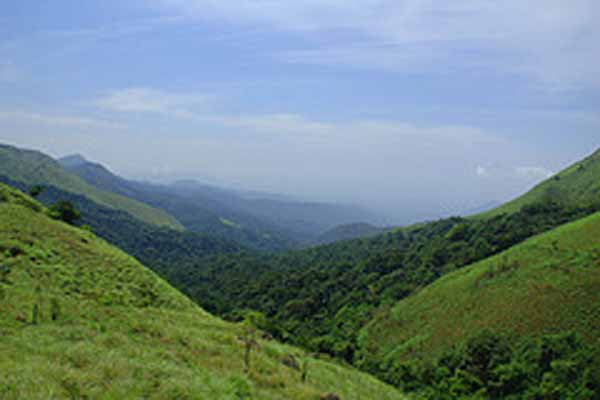
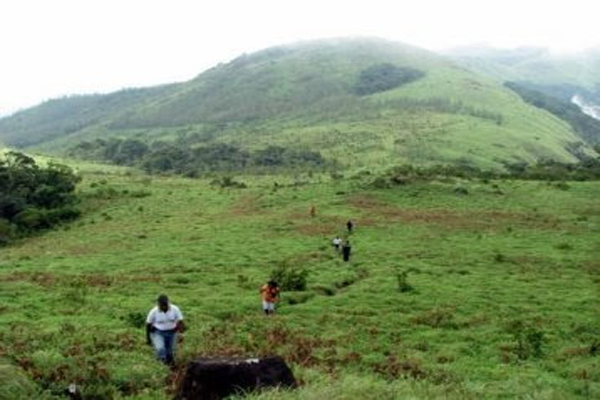
TADIYANDAMOL is the highest mountain in Coorg (Mercara) Dist (1750 Mtrs. MSL). The climb to this mountain is gradient passing through grassland. If you are the type who likes to mingle with nature, savor the snow-like mist romance upon mountain slopes, feel the tingle of the cool and gentle breeze seep into your skin, watch the leaves flutter in dance-like movements, hear the sounds of chirping birds fill the air, and then Coorg is the place for you. Kodagu is noted for its scenic beauty. Hiking, cross-country, or simply motoring down mountain trails in Coorg, the one encounter panoramic views of the morning mist rolling down thickly wooded hill slopes and the undulating paddy fields and neat rows of coffee bushes resplendent under the blue skies. Coorg is now a flourishing agricultural center; Kodagu produces cash crops of coffee, rice, orange, pepper and cardamom. With its misty mountains and dense forests, Coorg seems like a little corner of England to the British. They left behind a legacy, which is still an important source of national wealth. The well laid coffee plantations in Coorg account for almost half of Karnataka's coffee production. And Karnataka continues to be India's largest producer of coffee. Other remainders of the colonial past are the spacious estate bungalows, many of which still have British names and the meandering roads that wind through the district. |
Nearest Towns: |
| 16+kms (Sringeri) ,Virajpet |
Location info:India->Karnataka->Coorg- > Madikeri |
| Distances:From Bangalore it is 350+ kms |
| Camping Sites: In and around the foot hills of the peak there are lots of open spaces where camp can be set up |
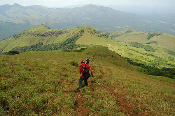
| Trek Length: One to Two Days |
Route Info: |
| Bangalore > Mysore > Hunsur > Gonikoppal > Virajapet bus stand>Virajpet > Kabbinakaadu > kaikamba > kakkabe > Napoklu.
Get down at Kakkabe, which is a small town, if you want to get some water or food. The start of the trek is actually a couple of Km before Kakkabe while coming from Virajpet.You can come to Kakkabe from Madikkeri also. There are quite a few buses from Madikkeri to Virajpet that pass through Napoklu and Kakkabe. |
Best Time To Visit: |
| October to Feb.,Early winter. |
Worst Time To Visit: |
| Probably summers. |
Difficulty Level: |
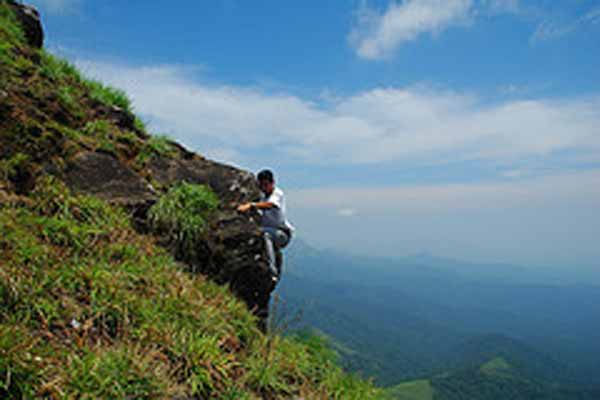
| Easy to moderate with steep climbs. |
Summary: |
|
Tadiyendamol, the tallest peak in Kodagu, is another trekker's paradise. From the peak you can view the distant Arabian Sea and the spellbinding beauty of Kodagu all around.The best time to visit Tadiyendamol is early winter. "Highest Point" as called in Kodava language, this peak is the highest one in the Madikeri district. It is situated near Vir Raj Pet, about a 30kms away, on the way to Napoklu, Bhagamandala. This peak is just adjacent to the Makutta forest. On the way, you also get an old palace called 'Nalku Naadu Aramane'. At a height 1800 m, Tadiyendamol is the second highest peak in Karnataka. The peak belongs to the group of taller peaks between Himalayas in the north and Nilgiris in the South. Tadiyendamol is a part of the range of Western Ghats that lie in Coorg District of Karnataka. This range experiences a salubrious climate through out the year. Elephants, bison, tigers, wild cats, and variety of birds habitat the thick vegetation. Plenty of waterfalls and natural springs adorn the valleys. The flora & fauna of Coorg add to the beauty of the valley. Most of the natural vegetation around the peak in this range is taken over by Plantation growers and converted to Plantations of coffee, pepper, cardamom, beetle leaves, and areca nut. The forest department well maintains the forest range with early burning of weeds and shrubs, planting trees to re-grow the forest and maintenance of trees. The effort of the association of forest guards and local people in maintaining this forest range is commendable Catch the 10:45 PM K.S.R.T.C Rajahamsa Bus to Virajpet. From the Virrajpet, catch the 6:45 AM local bus to Kakkabbe and get down at Aramane stop, a 60-minute journey.From the Aramane bus stop, a 1 KM partly tar – partly muddy road would lead you to the palace. From the palace there is just one route, which goes all the way to the Tadiyandamol peak. On the way up, after around 2 hours of walk, you?ll find a bolder, here you can find 2 paths, the left one takes you to the peak & the other takes you to kerala [iruti]. On this path you will find a stream & that?s the last point of water source. Hence most people camp here in the night. On the way back, get back to the aramane bus stop. From here you can find frequent local buses to Madikeri or back to Virrajpet. Catch the KSRTC bus back to Bangalore. |
Things To Look for: |
| Sun rise and sun set from the peak is a must.The Beauty of the place |
Things To Be Aware Of: |
| Leeches,Winds at the peak |
Things To Carry: |
|
References |
| http://www.hikesandtreks.com/raiddekarnataka04.html#tadiyandamol |
Important Phone Numbers : |
Permission: |
SELECT YOUR HOLIDAY DESTINATION
-
Aero Sports in Karnataka
-
Archaeology in Karnataka
-
Beaches in Karnataka
-
Bird Sanctuaries in Karnataka
-
Bouldering Spot in Karnataka
-
Camping in Karnataka
-
Cave Explorations in Karnataka
-
Culturals Place in Karnataka
-
Dams in Karnataka
-
Fairs in Karnataka
-
Festivals in Karnataka
-
Go Karting in Karnataka
-
Hill Stations in Karnataka
-
Historical Places in Karnataka
-
Holiday Resorts in Karnataka
-
Islands in Karnataka
-
Landscape in Karnataka
-
Mountain Biking in Karnataka
-
National Parks in Karnataka
-
Orbit Network
-
Para Sailing in Karnataka
-
Pilgrims Destinations In Karnataka
-
River rafting in Karnataka
-
Rivers in Karnataka
-
Rock Climbing in Karnataka
-
Safari in Karnataka
-
Temples in Karnataka
-
Trekking in Karnataka
-
Water Sports in Karnataka
-
Waterfalls in Karnataka
-
Wildlife Sanctuaries in Karnataka


